Could the earliest weakening of the polar vortex on record bring UK snow?
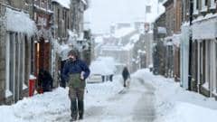
High above the Arctic, powerful winds usually circle the North Pole each winter, helping trap some of the coldest air on Earth. While such disruptions can occur during winter, scientists say an event this early in November is unprecedented in modern observations. Similar disruptions in past years have sometimes been followed by colder weather affecting parts of Europe and North America.
However, as this is happening so early in the season, there are few historical examples to compare with and it could throw current winter forecasts into even more uncertainty. Strong westerly winds form in the stratosphere, roughly 10 to 30 miles (15-50km) above Earth's surface, locking the coldest air near the pole. Atmospheric disturbances can cause the air high up to start warming which then makes the vortex winds weaken.
This sudden stratospheric warming (SSW) can eventually lead to the strong westerlies reversing into easterly winds.
More world
- राणाकालीन पुरातात्त्विक स्वरूपमा फर्किँदै विश्व निकेतनNepal Khabar
- भारतीय विदेश सचिव मिस्री र कांग्रेस सभापति थापाबीच भेटवार्ताNepal Khabar
- Nepal’s remaining Bhutanese refugees seek legal recognitionKathmandu Post
- Reconstruction aid, strategic ties, pending disputes on PM’s India visit agendaKathmandu Post
- Gaza turns discarded cooking pots into seawallsAl Jazeera
- A son in prison, a daughter gone: Singapore parents face heartbreakSouth China Morning Post